Native People of the North West

bella_coola_indians_-_native_north_america_med

By Wilhelm Sievers (1860 – 1921) (Allgemeine Landeskunde: Amerika (1895-1897))

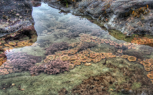
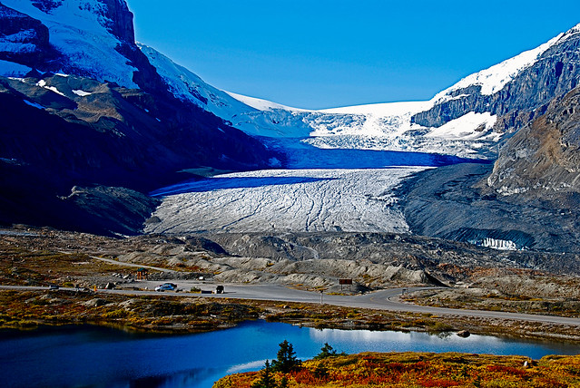
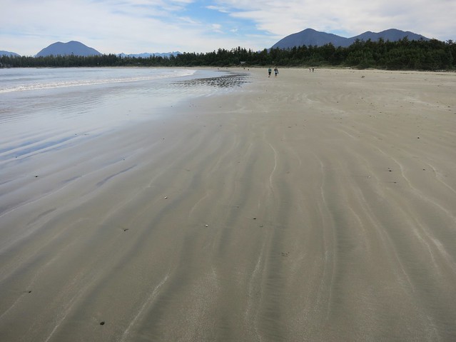
The Pacific coast is a land of mountains, gigantic trees, islands and deep-cut fjords. Every year salmon swam up the rivers to spawn, plenty of seals, otters and fish could be found close to shore, as well as shellfish of various kinds. Food was also abundant in the form of deer, bear, elk, and mountain goat. The climate is mild and wet.

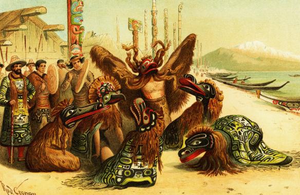
In this environment the Coast Salish people lived. They made their houses out of the abundant cedar, as well as bowls and spoons and other useful items. They also carved out cedar logs to make canoes with which they not only navigated the inlets and rivers, but also went out to the open ocean hunting for whales. And all their wood-cutting and carving was done with simple tools made out of stone and shell!

From the resources around them, they spun cedar fibres into twine for fishing nets and lines, and wove baskets, hats and matts from the bark and roots of cedar trees. They also made their clothing and blankets from cedar bark and mountain goat wool and dog hair.

They are maybe best known for the totem poles they carved with figures that represented the legends of a tribe, adventures they had experienced, or special events or memories.

Some of these people were very wealthy and potlatches were held, where a chief would display how rich and generous he was by giving gifts to those he chose. However, there were also people who were merely slaves.

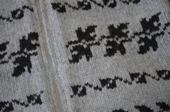
The coming of the Europeans drastically changed the culture and ways of the Coast Salish as it did across the rest North America. Sheep were introduced to Vancouver Island in the 1850’s providing a much easier source of wool and some of the native women were taught to knit by missionaries. Eventually, the native women in the Cowichan Valley began to knit sweaters with geometric designs or figures on them. They became popular and a means by which some families could put food on the table. The Cowichan sweater is still popular today.

sweaterWe are often not aware of the true cost of clothing when we buy items to wear, and the prices we pay do not always reflect the true value if everyone along the line of production was paid fairly.

To make a sweater, the sheep has to be fed for a year while it grows it’s wool, it has to be sheared, and then the wool washed, combed, spun into yarn and then knit. What do you think a fair price would be for a hand-knit, 100% wool sweater that will last for years?

yetsassweaterIf you can find it at your library, Yetsa’s Sweater by Sylvia Olsen is a lovely book to read about the making of a Cowichan sweater.

Activity: Try learning how to knit. Here is a website that will instruct you in the basics: Imagination Soup

If you get really good at knitting, you may want to try knitting for a charity such as Knit-a-Square.

Western Provinces

This week, with the help of photographers from flickr, we will just enjoy looking at some photos of lovely places in Western Canada, which includes Alberta and British Columbia.

Capilano Suspension Bridge CLIFFWALK Preview

Capilano Suspension Bridge Cliff Walk, BC – Photo by Jeremy Lim

Wintertime At Botanical Beach

Botanical Beach, BC – Photo by James Wheeler

Columbia Icefield, Canada

Columbia Icefields, BC – Photo by Gary Ullah

Hoodoo Country

Hoodoos, AB – Photo by Aaron

Rippled sand, Long Beach

Long Beach, BC – Photo by Ruth Hartnup

Activity: With the help of google maps or an atlas, find these places and mark them on your map of Canada. Which one would you like to visit?

Pacific Rim National Park

On the far western side of Canada, off the coast of mainland British Columbia, there is a large landmass called Vancouver Island. On its western side lies Pacific Rim National Park which includes Long Beach, Broken Islands, and the West Coast Trail.

Long Beach, Pacific Rim NP

It is beautiful! Temperate rainforest, sandstone cliffs, waterfalls, caves, and beaches. Take a look at this: Parks Canada.

The West Coast Trail was originally cut for a telegraph line back in 1890 and as a means to assist those who happened to end up on the coast due to shipwreck. The area along this coast is known as the Graveyard of the Pacific. The trail is 75 km long, which means a 6-8 day hike starting at Patcheena Bay near Bamfield and ending at Gordon River near Port Renfrew.

There are two things on the western coast of Canada that really fascinate me: big trees and spawning salmon.

Big Trees

carmanah

The big trees that grown along this coast are the Western Red Cedar, Douglas Fir and Sitka Spruce.

Western Red Cedar can grow up to 60 metres tall. Their wood is very valuable wood as it is resistant to decay and insects and remains good for over 100 years. It has a lovely but  strong aroma. The native people used it for canoes, totem poles, building their long houses, and other useful things. The bark tears off in long strips and was used for mats, fishing line, and nets. This tree can live over 1000 years and is sometimes called the “Tree of Life”.

Douglas Fir can reach a height of 85 metres on the coast. It is a tough, hard wood good for building wharves and bridges. The cones interest me because the little bract that sticks out of the scales looks like the tail and legs of a little mouse hiding in the cone.

carmanah2

Sitka spruce usually grows to about 70 metres but the tallest (Carmanah Giant) is 95 metres tall and about 500 to 700 years old. Natives used the roots for hats, baskets, rope and fishing line. The pitch was useful to caulk boats, waterproof harpoons and fishing gear, and as medicine for burns, boils, and skin irritations. The wood is soft, light and flexible but strong. It is used for sounding boards in pianos and violins.

Take a virtual walk through the rainforest: 3 Minutes of Heaven

Salmon

Salmon are the lifeblood of the rainforest. There are five species of salmon: chinook (the largest), coho, chum, sockeye, and pink (the smallest). They are anadromous, which means they are born in fresh water, live most of their lives at sea, and then return to the same river to lay their eggs.

salmon

They migrate to the rivers in the fall and may travel 50 km per day upstream. They do not eat while they are making this journey which may take up to 12 days. As the days go on, their bodies become flabby and torn and they change colour before they finally lay their eggs and then die.

Many are eaten by bears and wolves during their journey, but they are a major source of nourishment for the rainforest soil and trees.

The eggs lie in the riverbed, covered by small rocks and pebbles over the winter. In the late winter or early spring they begin to hatch and for the first four months the live off the yolk sac. Some species head off directly for the ocean, others stay in the stream for a year or two. A salmon may lay around 7000 eggs, but it is likely that only a few will live to grow up. Many are eaten by mink, otters, raccoons, ducks, bears and other fish.

Where the rivers meet the sea, an estuary exists where fresh and salt water mix. It is a place full of nutrients and organic matter that has been carried downstream. Many of the baby fish will spend days or months in the estuary before they leave for the open ocean. They will spend up to 4-5 years out in the ocean before they begin the trip back to the stream they hatched in to start the cycle all over again.

Unfortunately clearcutting and other practices have damaged many coastal streams and negatively impacted the salmon populations. There are restoration efforts underway and maybe it will not be too late to make a difference.

Learn more about salmon: Pacific Salmon Foundation

BOOKS:

  • North American Rainforest Scrapbook by Virginia Wright-Frierson
  • The Tree by Dana Lyons
  • Salmon Forest by David Suzuki
  • Salmon Stream by Carol Reed-Jones
  • Salmon Creek by Annette LeBox

These are lovely books as well about the Great Bear Rainforest which is on the mainland:

  • Nowhere Else on Earth by Caitlyn Vernon
  • The Salmon Bears by Ian McAllister
  • The Sea Wolves by Ian McAllister
  • The Great Bear Sea by Ian McAllister

Come to British Columbia

bcferry The motto for British Columbia is “splendour sine occasu” which means splendour without diminishment, and it is a splendid province. It is a land of towering snow-capped mountains, rushing, foaming rivers and trees so tall you can barely see the tops. It is also home to the only real desert in Canada, huge cattle ranches, and a warm sheltered spot where fruit trees grow. Because of this large variety in climate and landscape, British Columbia has the greatest variety of animal and plant life in Canada.

On the far western side of Canada, where the waters of the Pacific Ocean roll in and out every day, there are about 6500 islands and islets scattered down the coastline. These are the tops of mountains sticking out of the sea. They are mostly rocky wilderness and because the ocean keeps the temperatures fairly mild and wet, some of the tallest trees grow here in what is called the Coast Rainforest. One tree – a Sitka Spruce – in the Carmanah Valley on Vancouver Island is 95 metres tall!

Vancouver Island is the biggest of these islands and on its southern tip is the city of Victoria which is the capital of British Columbia. The mild weather here caused by the ocean means that quite often there are flowers blooming in the middle of winter. Spring usually begins much earlier here than in other places in the province.

To get to the mainland, one would have to take a ferry ride or an airplane. The ferries that travel between Vancouver Island and the mainland are quite large. Some of them are the world’s largest double-end ferries. They are 167 metres long and can carry 1650 passengers and 470 vehicles each. The ferry trip would end up on the mainland near the large city of Vancouver – home to half of the population of B.C.

This is where the Fraser River empties into the ocean and the land is flat and rich and contains almost half of B.C.’s farms. It is nestled between the ocean and the Coast Mountains. Since it is up against the mountains, the clouds coming off the ocean must rise to get over them, and as the moist air rises, it cools and the water condenses and falls as rain or snow. Therefore Vancouver gets a lot of precipitation and over the mountains on the other side lies the interior plateau which gets very little.

The interior plateau is a high piece of rugged, rolling hills, sandwiched between the Coastal Mountains and the mountains further inland. The southern part of this interior plateau is the Okanagan Valley. Its soil is rich and its climate is sunny, warm and dry. Seven lakes spill down it’s centre, the biggest being Okanagan Lake, flowing into the Columbia River. Since it is does not get a lot of rain, people have had to figure out ways to get water to their fruit trees, vineyards and vegetables. At the southern tip of this valley, on the eastern shore of Osoyoos Lake is a little “pocket” desert where prickly pear cactus and sagebrush grow. It is called a pocket desert because it is surrounded by land that is not desert. It is home to many birds of prey including the endangered burrowing owl and other species of animals that are found virtually nowhere else in Canada.

To the north of the interior plateau is good grassland which provides the substance of many cattle ranches. The northeast of the province is The Peace River Valley. It is one of B.C.’s major agricultural areas centred on grain farming. North of this is mainly mountainous wilderness.

PROJECT: Find the following places on a map: Gulf Islands, Vancouver Island, Victoria, Queen Charlotte Islands, Vancouver, Okanagan Valley, Peace River Valley